49 PEARL AVE
Owner Information
ROSENTHAL LOIS
49 PEARL AVE
WINTHROP, MA 02152


Property Details
49 PEARL AVE is classified as a Two-Family Residential (2 unit).
The primary structure on this property was built in 1925. There are 6,888ft2 of built area within this property. There is 3,985ft2 of residential/living space within this property. This property is listed as having 8 rooms.
49 PEARL AVE is valued at $689,300. The land is valued at $294,400 and the structures are valued at $390,200. There is an additional valuation of $4,700 on this property.
49 PEARL AVE was last sold on Tuesday, August 4, 1998 for $200,000.
Assessment data from fiscal year 2019.
Flood Data
This property has multiple flood prone designations.
| Zone | Description | BFE | Area |
|---|---|---|---|
| AE | within floodplain | 11 | 0.01 (10.4%) |
| AO | shallow flooding, up to 1 feet | None | 0.11 (89.59%) |
This information is sourced from the FEMA National Flood Hazard Layer. See our full disclamer.
Broadband Internet Providers
| Provider | Type | Bandwidth (mbps) | |
|---|---|---|---|
| Viasat Inc | Satellite | 100 | 3 |
| VSAT Systems, LLC. | Satellite | 2 | 1 |
| HughesNet | Satellite | 25 | 3 |
| GCI Communication Corp. | Satellite | 0 | 0 |
| Comcast | Cable | 1000 | 35 |
| Verizon New England Inc. | DSL | 15 | 1 |
Broadband service provider data from December 2020.
Adjacent Properties
- 45-47 PEARL AVE
Other, Open Space owned by LIROPOULOS CHRISTOS S - 45-47 PEARL ST #1
Residential Condominium owned by DARCANGELO JESSICA L - 45-47 PEARL ST #2
Residential Condominium owned by HURLEY KEVIN - 45-47 PEARL ST #3
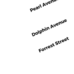
Residential Condominium owned by RODIS JONATHAN S - 48 DOLPHIN AVE
Two-Family Residential owned by SEDOV-FONTES ELINA TRUSTEE OF - 140 W SHORE DR
Single Family Residential owned by TAHER HOSSEIN S - 137 W SHORE DR
Two-Family Residential owned by DARMAN ROBERT A - 135 W SHORE DR
Two-Family Residential owned by AVDISPAHIC EDIN